Hungary Neighbouring Countries and European Borders
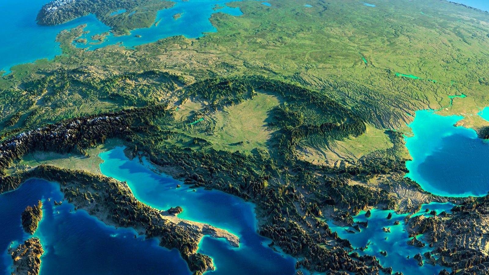
Hungary’s Neighboring Countries
Hungary sits smack dab in the middle of Central Europe, surrounded by a handful of other nations. Let’s take a closer look at its connections with Slovakia, Ukraine, Romania, and Serbia.
Slovakia and Ukraine
Slovakia:
- Location: Up north
- Border Length: About 627 km (390 miles)
- Key Border Regions:
- Bratislava Region (Slovakia)
- Borsod-Abaúj-Zemplén County (Hungary)
Running along the Danube River, the border with Slovakia is as scenic as it is historic. The shared background between these two neighbors includes a mix of cultural history and a Hungarian community living in Slovakia.
Ukraine:
- Location: Off to the northeast
- Border Length: Roughly 136 km (84 miles)
- Key Border Regions:
- Zakarpattia Oblast (Ukraine)
- Szabolcs-Szatmár-Bereg County (Hungary)
The Carpathian Mountains slice through the Hungary-Ukraine border, showcasing stunning landscapes and wildlife. In spite of regional tensions, efforts in infrastructural improvement and trade go on between the two nations.
| Country | Border Length (km) | Key Border Regions |
|---|---|---|
| Slovakia | 627 | Bratislava Region, Borsod-Abaúj-Zemplén County |
| Ukraine | 136 | Zakarpattia Oblast, Szabolcs-Szatmár-Bereg County |
Romania and Serbia
Romania:
- Location: Runs along the east and southeast
- Border Length: Around 448 km (278 miles)
- Key Border Regions:
- Bihor County (Romania)
- Szatmár County (Hungary)
The ties between Romania and Hungary are strong on both the economic and cultural fronts. Border towns like Oradea become bustling centers for trade and cultural mingling.
Serbia:
- Location: Down south, particularly the Vojvodina area
- Border Length: Comes in at about 151 km (94 miles)
- Key Border Regions:
- Vojvodina (Serbia)
- Csongrád-Csanád County (Hungary)
Hungary’s line with Serbia is steeped in historical significance, particularly around Vojvodina. There’s plenty of collaboration here, focusing on things like farming, energy, and getting stuff from point A to point B.
| Country | Border Length (km) | Key Border Regions |
|---|---|---|
| Romania | 448 | Bihor County, Szatmár County |
| Serbia | 151 | Vojvodina, Csongrád-Csanád County |
Knowing who’s next door to Hungary adds context to its cultural and geopolitical vibe. These borders with Slovakia, Ukraine, Romania, and Serbia are more than lines on a map—they’re bustling pathways of connection in the areas of politics, commerce, and culture. Curious about borders elsewhere? Check out articles on dominican republic neighboring countries and ecuador neighboring countries.
Further Neighbors
Hungary’s neighborhood is a patchwork of diverse connections, as it snuggles up against a variety of countries. Here, we’ll take a look at Hungary’s lines with Croatia, Slovenia, and Austria.
Croatia and Slovenia
Just head south, and you’ll bump into Croatia and Slovenia.
Croatia:
- Border runs about 329 km
- Main passes: Letenye-Goričan, Barcs-Terezin
- Big towns nearby: Nagykanizsa, Zalaegerszeg
Slovenia:
- Border stretches roughly 102 km
- Main points: Rédes-Dolga Vas, Tornyiszentmiklós-Pince
- Nearby cities: Zalaegerszeg, Lendava
While the size of the borders may not be jaw-dropping, the ties—historical, cultural, and in the wallet—are pretty tight. Folks from these areas trade, tour, and build stuff together all the time.
| Country | Border Length (km) | Major Cities Near Border |
|---|---|---|
| Croatia | 329 | Nagykanizsa, Zalaegerszeg |
| Slovenia | 102 | Zalaegerszeg, Lendava |
Looking for more scoops on other neighbors? Check out ecuador neighbouring countries or egypt neighbouring countries.
Austria’s Border with Hungary
Shift west, and you’ll hit Austria, a neighbor Hungary’s shared golden moments with in history.
Austria:
- Border line: About 366 km
- Key spots: Hegyeshalom-Nickelsdorf, Sopron-Klingenbach
- Cities in the vicinity: Sopron, Szentgotthárd
Getting from one side to the other is a breeze along this border, which is a lifeline for trade and travel. It played a big role in past political tales and now eases movement in the Schengen Zone.
| Country | Border Length (km) | Major Cities Near Border |
|---|---|---|
| Austria | 366 | Sopron, Szentgotthárd |
Hungary’s borders aren’t just lines on a map. They’re rich threads in its political and economic scene. Want a deeper peek into how other countries play it? Swing by our takes on finland neighbouring countries and france neighbouring countries.
Hungary’s Modern Borders
Hungary’s borders look the way they do today thanks to a mix of treaties and crazy political changes, especially after the World Wars. Let’s break down what happened with the Treaty of Trianon and how things got shuffled around after World War II.
Treaty of Trianon Consequences
Picture it: June 4, 1920. The Treaty of Trianon, which tossed Hungary’s borders around like a hot potato, left a big mark on the country. After World War I, this treaty took a whopping 71% of the land from the former Kingdom of Hungary. Here’s the scoop on who got what:
| Country | Area Acquired (km²) | % of Pre-Trianon Hungary |
|---|---|---|
| Romania | 103,093 | 31.94% |
| Czechoslovakia | 61,633 | 19.87% |
| Yugoslavia | 20,551 | 6.63% |
| Austria | 4,659 | 1.44% |
| Italy | 37 | 0.01% |
Source info extracts from the depths of Wikipedia.
These shifts stuck Hungarian folks in neighboring countries, sparking worries for Hungary’s government (Britannica). Even today, what happened decades ago still pops up in talks about what it means to be Hungarian.
Post-World War II Revisions
Originally shuffled by the Trianon, Hungary’s layout wasn’t set in stone. During World War II, Hungary snatched back some lands through deals and battles. Yet, after 1945, those temporary wins slipped away with the Allied triumph.
The 1947 Treaty of Paris slapped back the Trianon borders—with a little tweak that gave Czechoslovakia a boost (You know where.). Hungary found itself staring at borders that were much tighter than before all the Trianon drama.
Post-war challenges hit, mostly about Hungarians living outside their shrunken homeland. Hungary’s communist regime kept quiet on these issues, being all buddy-buddy with other communist nations (Britannica). But the 1970s rolled around, and the global focus on human rights started shaking things up. By the late 80s, big geopolitical and economic changes meant Hungary had to start caring a lot more about those folks in other lands. This shift still runs deep in Hungary’s modern diplomatic shuffle.
For more musings on how borders play tag with diplomacy, check out how France deals with its neighbors and their wild pasts.
Geographical Features
Hungary, a gem in Central Europe, offers a mix of landscapes that keep it interesting: from flat expanses to hilly heights. Let’s explore two main features: the Great Hungarian Plain and the Hungarian Mountains.
Great Hungarian Plain
Simply put, the Great Hungarian Plain, or Alföld, is the kingpin of Hungary’s geography. Stretching out east of the Danube River, it sprawls across more than half the country. This vast plateau boasts a mix of terrains, from lush fields to swampy stretches. For over a thousand years, it has played host to Hungarian life. Here, you’ll find the puszta, a huge grassland that embodies the wild, untamed nature of the region’s scenery (Geography of Hungary).
Things to know about the Great Hungarian Plain:
| Feature | Explanation |
|---|---|
| Location | Resting east of the Danube River |
| Size | Takes up over half of Hungary |
| Terrain | Fertile spots, wastelands, swamps |
| Historical Role | Peopled for more than a millennium |
| Landmark | The vast puszta grasslands |
Hungarian Mountains
Hungary’s mountain areas split into four chunks: Alpokalja, Transdanubian Mountains, Mecsek, and North Hungarian Mountains, each with its own flavor and hidden treasures in the form of minerals.
Alpokalja
Found out west, near the Austrian line, Alpokalja features gentle hills and modest mountains.
Transdanubian Mountains
Lying north of Lake Balaton, these hills are famous for their limestone and scenic views.
Mecsek
Down south, the Mecsek Mountains are not only pleasing to the eye but are rich with plant and animal life.
North Hungarian Mountains
This part is loaded with coal and iron. The North Hungarian Mountains boast the tallest peaks in Hungary and are dotted with cherished national parks and nature reserves.
Interesting bits about Hungarian Mountains:
| Mountain Area | Traits | Known Minerals |
|---|---|---|
| Alpokalja | Gentle hills, modest peaks | N/A |
| Transdanubian Mountains | Limestone hills | N/A |
| Mecsek | Rich in flora and fauna | N/A |
| North Hungarian Mountains | Tallest peaks, parks | Coal, iron |
Hungary’s geographical mix, from the vastness of the Great Hungarian Plain to the mineral-packed Hungarian Mountains, adds a special touch to its natural allure. Want to find out how Hungary’s borders evolved? Check out the Treaty of Trianon Consequences and Post-World War II Revisions sections.
Climate and Agriculture
Hungary’s climate and fertile land have a big say in how much it can crank out when it comes to farming. Knowing these factors gives us a good grasp of their farming game.
Continental Climate
Hungary mainly experiences a continental climate—think cold winters and summers that can heat up like they’re on a mission. We’re talking average yearly temps of about 10 °C (50 °F), but some wild swings can happen, from blazing 42 °C (108 °F) in the summer to a bone-chilling -35 °C (-31 °F) in winter (Geography of Hungary).
West Hungary generally gets more rain than the east, which can dry up like a raisin during those scorching summer months. Here’s how the seasons typically break down:
| Season | Temperature | Notes |
|---|---|---|
| Summer | 42 °C (108 °F) | Hot as a furnace |
| Winter | -35 °C (-31 °F) | Bundled up cold |
| Annual Average | 10 °C (50 °F) | Mix of hot and cold |
Arable Land and Crop Production
Agriculture is no small deal in Hungary, with about 48.57% of the land dedicated to it. That’s a solid chunk prime for farming (Geography of Hungary). The main farming regions include the Little Hungarian Plain, Transdanubia, and the Great Hungarian Plain.
These areas churn out a bunch of different crops, like:
- Corn
- Wheat
- Barley
- Sunflower
- Potatoes
- Various fruits
| Agricultural Zone | Main Crops |
|---|---|
| Little Hungarian Plain | Corn, Wheat |
| Transdanubia | Barley, Sunflower |
| Great Hungarian Plain | Potatoes, Fruits |
The combo of rich soil and friendly weather really boosts the variety and richness of Hungary’s harvests. If you are curious about more global locales, you might find these articles about ethiopia neighboring countries or iraq neighboring countries to be enlightening.
Hungary’s Diplomatic Relations
NATO and EU Memberships
Hungary’s been at the table with Europe quite a bit thanks to its NATO and European Union badges. They joined NATO in ’99 and jumped onto the EU bandwagon by 2004 (Wikipedia). These affiliations don’t just hang on the wall; they actively mold Hungary’s foreign policy and diplomatic moves.
For Hungary, NATO’s not just a military squad; it’s a safety net for the neighborhood. Being part of NATO means Hungary toes the line on shared principles and dives headfirst into all sorts of military and political projects.
The EU membership throws Hungary into the mix of economic mingling, gateway to European markets, and decision-making lanes on trade, farming, and development. With the EU’s help, Hungary’s been paving roads and boosting its economy, carving out a sturdy spot in Europe.
International Cooperation Initiatives
Hungary doesn’t do the lone wolf thing; it rolls with several international partnerships to fortify political, economic, and cultural bridges in its vicinity. These moves echo Hungary’s pledge to keep the neighborhood stable and on an upward spiral.
In the mix of Hungary’s buddies are Serbia and Ukraine. Initiatives like the Nyíregyháza Initiative are all about nudging Ukraine closer to Europe and luring about 3 billion euros worth of investments to the Balkans (Hungarian Embassy Los Angeles).
Hungary also hangs out with some regional cliques:
- The Visegrád Group: This cool club, including Czech Republic, Poland, Hungary, and Slovakia, is all about finding common ground for Central Europe doings.
- The Regional Partnership: With Austria, Czech Republic, Poland, Hungary, Slovakia, and Slovenia riding along, it’s a hub for amping up economic and political teamwork.
- The Central European Initiative: A bigger shindig with 18 countries working together on regional and European integration efforts.
- Quadrilaterale: A combo of Croatia, Hungary, Italy, and Slovenia, this crew coordinates on the political, economic, and cultural dance floor.
Hungary’s position on the geopolitical map is quite the tango between European pals and economic kinships, like the ones with Russia. Prime Minister Viktor Orbán’s moves, such as the no-go on sending arms to Kyiv while sealing a gas arrangement with Russia, highlight the tightrope Hungary walks in diplomatic relations.
Check out more on Hungary’s diplomatic scenes and cliques with neighbors such as ecuador neighboring countries, egypt neighboring countries, and france neighboring countries.

