Tonga Neighbouring Countries and Pacific Islands
Tonga’s Neighboring Countries
Geographical Location Overview
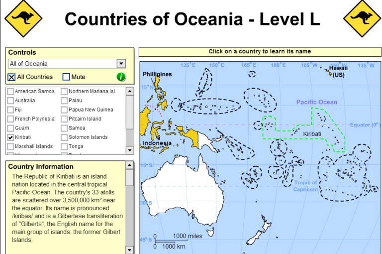
Tonga’s right in the thick of Oceania, starring its 169 islands, and 36 of those party islands are inhabited. These islands are divided into three groups: Vavaʻu, Haʻapai, and Tongatapu. Picture Tonga as a string of pearls stretching 800 kilometers (500 miles) from north to south. If you squint at a map, you’ll find Tonga chilling south of Samoa, acting like a bridge between Hawaii and New Zealand.
| Neighboring Country | Direction from Tonga |
|---|---|
| Samoa | North |
| Fiji | West |
| Wallis and Futuna | Northwest |
| Niue | East |
Tonga’s maritime territory is impressive, boasting an exclusive economic zone sprawling over 659,558 square kilometers (254,657 square miles), reaching out 200 nautical miles from the coast. It’s as if Tonga threw a lasso around the ocean, pulling in a bounty of scattered islands and marine goodies.
Proximity to Samoa
Samoa is just a stone’s throw north of Tonga. This close-knit relationship means they’re like family when it comes to culture and history. Their geographical near-hug supports strong ties in trade, tourism, and cultural exchanges.
| Aspect | Tonga | Samoa |
|---|---|---|
| Geographical Position | About 2000 kilometers northeast of New Zealand | Roughly 5,000 kilometers southwest of Hawaii |
| Exclusive Economic Zone | 659,558 kilometers² | 131,000 kilometers² |
| Main Islands | Vavaʻu, Haʻapai, Tongatapu | Upolu, Savai’i |
The connection between Tonga and Samoa gives rise to both opportunities and challenges, especially when it comes to managing the sea bounty and political scenarios. Tonga’s assertive hold on its sea territory boosts its clout in the region, especially with neighbors like Samoa. This bond underscores their dedication to keeping the peace and pushing for growth.
If you’re up for more neighborhood gossip, check out our deep dives into San Marino neighboring countries, Sao Tome and Principe neighboring countries, and Singapore neighboring countries.
Geography of Tonga
Island Groupings
Tonga’s a cluster of 169 islands, and 36 are lucky enough to have people. The islands fit snugly into three big groups: Tongatapu, Ha’apai, and Vava’u.
- Tongatapu Group: This one’s way down south, with the capital island, Tongatapu, leading the charge.
- Ha’apai Group: Chillin’ in the middle, this one’s got tiny islands all around.
- Vava’u Group: Up in the north, it’s famous for its stunning views and amazing marine critters.
These groupings keep things organized and make it easier for folks to get around and run the show in the nation.
Tonga’s Largest Island
When it comes to size, Tongatapu is king—it’s the biggest chunk of land Tonga’s got, spreading over 257 square km (that’s about 99 square miles if you prefer). This place is buzzing with activity as it’s home to Nukuʻalofa, the capital city, where all the political and business action happens.
Key Features of Tongatapu:
- Area: Spans 257 square km
- Significance: The core for government action and business buzz.
- Location: Southern tip top of Tongatapan territory.
- Capital City: Nukuʻalofa holds the crown here.
The Tongan Volcanic Arc
Some parts of Tonga got fiery beginnings, thanks to the Tongan Volcanic Arc. It’s like a geological hotbed with western islands born from volcanic activity. This stems from the Pacific plate doing the ol’ under-the-Australia-India plate tango. Islands like ‘Ata, Fonuafo’ou, and Tofua popped up thanks to this geological dance.
Characteristics of Tongan Volcanic Arc:
- Western Islands: You’ve got ‘Ata, Fonuafo’ou, Tofua, and the gang.
- Formation: These islands crashed the party via the Pacific plate sliding under Australia-India’s foot.
- Geological Activity: It’s a lava-life, with islands coming alive.
- Western vs. Eastern Islands: The west gleams with volcanic roots, unlike the eastern islands, which sit on the mostly hidden Tonga ridge.
Knowing how these island crews and volcanic shenanigans work gives a peek into Tonga’s unique terrain and nature’s wild side. If you’re curious about more of Tonga’s neighbors, you can check out articles on other neighboring countries and their geographical tidbits.
Maritime Claim of Tonga
Tonga’s stretch of ocean highlights what it calls its own, defining its borders and the treasures it can dig into and look after. Getting a grip on just how far Tonga’s maritime reach goes is key for seeing why it’s a big deal in the Pacific.
Exclusive Economic Zone
Tonga’s got a pretty massive reach with its Exclusive Economic Zone (EEZ), stretching out 200 nautical miles from its shore. We’re talking about a whopping 659,558 km² (that’s 254,657 square miles for those keeping score at home) (Wikipedia). Within this watery kingdom, Tonga’s got dibs on the marine goodies – fishing, mining, you name it.
| Area | Size |
|---|---|
| Exclusive Economic Zone (EEZ) | 659,558 km² (254,657 sq mi) |
| Stretch from Shore | 200 nautical miles |
With this wide-brimmed hat of a zone, Tonga can beef up its economy but also needs to guard what’s out there. Holding the reins means Tonga gets to pluck the resources Mother Nature’s given and keep its interests afloat.
Scattered Islands Coverage
Why’s Tonga’s EEZ so crucial? It’s the mold these scattered gems of islands are set in. Tonga’s a patchwork of islands spread across the South Pacific Ocean. Trying to reel in more oceanic claim, the EEZ lets Tonga keep tabs on a good chunk of water and its bounties.
The smattering of islands includes heavy hitters like the Tongatapu Group, Vavaʻu Group, Haʻapai Group, and the Niuas. All these groups and any smaller dots on the map fall under Tonga’s Maritime ticket.
| Island Group | Coverage Area |
|---|---|
| Tongatapu Group | Within EEZ |
| Vavaʻu Group | Within EEZ |
| Haʻapai Group | Within EEZ |
| Niuas | Within EEZ |
| Other Little Islands | Within EEZ |
The EEZ does more than stamp Tonga’s rights—it’s the guard dog for this stretch of sea. Keeping watch for sneaky fishing, steering safe fishing practices, and guarding deep-sea life fall under its gig.
Curious about the neighbors and their turf? Check our articles on Solomon Islands Neighboring Countries and Samoa Neighboring Countries.
Peeling back the layers of Tonga’s maritime claim showcases just why it’s a linchpin area, offering up fiscal fortunes and keeping an eye on its environmental treasures.
Impact of Neighboring Countries
Open Border Relations
In places where neighboring spots share similar wealth and politics, the borders tend to be chill. Folks can just mosey on across with ease. Take the European Union – you know, 27 countries squished together. Most of them let people bounce around freely. Only five of ’em make you flash a passport or an ID at the border (National Geographic Education).
What Stands Out:
- People get to wander and move around more freely.
- Cultures mix, plus economic chit-chat thrives.
Places that keep their borders loose often get tighter diplomatic and business connections. Sneak a peek at san marino neighboring countries or saudi arabia neighboring countries for more scoop on border policies.
Border Restrictions in Southeast Asia
Southeast Asia’s got a mixed bag when it comes to borders – from sorta open to buttoned-up tight. You need specific papers for visiting, working, or staying. Think visas, work permits, and such (National Geographic Education).
What’s the Deal with Restrictions:
- Foreigners need visas and work permits.
- Stay limits are set by government-issued papers.
Take Singapore, for example: they keep a close eye on borders and require paperwork galore. For more deets, check out singapore neighboring countries or timor-leste neighboring countries.
Closed Border Policies
Countries that slam the door shut on borders usually restrict movement big time. This is common in non-democratic places. Think North Korea, Myanmar, and Cuba, where crossing the line isn’t easy (National Geographic Education).
What’s Typical for Closed Borders:
- Moving around is a no-go.
- Barely any chatting with neighbors.
- Usually seen in non-democratic lands.
Go-To Examples:
| Country | Quirk |
|---|---|
| North Korea | Strict travel bans |
| Myanmar | Hardly any migration |
| Cuba | Tight residency and work rules |
For a deeper dive into tough border policies, scope out chats like serbia neighboring countries and sudan neighboring countries.
Knowing how neighbors influence border rules shows us how countries mix on money and social fronts. Peek at our pages on sri lanka neighboring countries or solomon islands neighboring countries for more spicy takes on regional politics.
Protection of Borders
Grasping how countries keep their borders secure clears up the relationships between neighboring nations. These protective measures combine military strength with a touch of law enforcement to keep things cool and steady.
Military and Law Enforcement Measures
When it comes to keeping the borders safe, countries roll out military might and cops to fend off unwanted invaders, take charge of who goes where, and watch over their goodies. Often this means soldiers and police squads are on the lookout to keep their homeland in one piece.
Take China, for example. They’ve teamed up with 28 nearby nations to sort out old border tiffs, signing pacts of neighborly love and handshakes with nine of them. It’s all part of a bigger plan to keep the peace in their neck of the woods when it comes to national security (Embassy of the People’s Republic of China in the United States of America).
| Region | Military/Law Enforcement Shindigs |
|---|---|
| China | Friendly treaties and military buddies with neighbors |
| Cambodia-Thailand | Military eyes on Preah Vihear Temple territory |
These actions are all about keeping things chill and handling any cross-border ruckus. They’re a big deal, especially where old border beefs run deep.
Border Conflict Examples
Border squabbles can be a real headache and sometimes explode into big-time drama. Take the dust-up between Cambodia and Thailand over Preah Vihear Temple. This clash got so heated that troops had to step in, and it’s still a thorn in their sides (National Geographic Education).
| Conflict | Countries Involved | Lowdown |
|---|---|---|
| Preah Vihear Temple | Cambodia, Thailand | Fight over temple turf, troops got involved |
Look at North and South Korea to see how tense these things can get. The DMZ between them is packed with military might, a constant reminder of their rocky relationship and a ploy to keep a lid on any funny business.
Some nations shut their borders tight, mostly those not into democracy, like North Korea, Myanmar, and Cuba, making it tough for folks to cross the line (National Geographic Education).
For more scoop on who rubs shoulders with who, check out san marino neighboring countries or sao tome and principe neighboring countries. These tip you off on how different countries tackle border issues and the juggling act of keeping borders friendly.
Islamic Influence in Southeast Asia
Spread of Islam
Since the 13th century, Islam began to waft into Southeast Asia, carried by the winds of trade. Muslim traders, hailing from places like Bengal, Gujarat, and Malabar, laid the initial foundation for Islam in the region as far back as the 10th century (Asia Society). Marco Polo penned the first account of a Muslim community in Southeast Asia in 1292, nestled in North Sumatra.
The Islamic tide surged forward significantly when the ruler of Melaka embraced Islam around 1430. Melaka, positioned perfectly as a bustling trade hub, used the Malay language to bridge diverse cultures across the Malay-Indonesian archipelago, thereby seamlessly weaving Islamic culture into the fabric of the region.
| Timeline | Event |
|---|---|
| 10th Century | Muslim traders reach Southeast Asia. |
| 1292 | First Muslim community noted by Marco Polo in North Sumatra. |
| 1430 | Ruler of Melaka adopts Islam. |
Islam in Southeast Asian Countries
Islam’s roots run deep across Southeast Asian soil. Let’s take a brief glance at its presence in several key countries:
| Country | Percentage of Muslim Population |
|---|---|
| Indonesia | 87% |
| Malaysia | 61% |
| Brunei | 67% |
| Thailand | 5% |
| Philippines | 6% |
| Singapore | 15% |
Indonesia stands as a giant under the Islamic banner, with Muslims making up about 87% of its population. Malaysia and Brunei also owe much of their cultural identity to Islam, with the faith ingrained as the official religion. Meanwhile, in Thailand and the Philippines, Muslims, though a minority, add significant cultural and religious hues to the national tapestry.
Looking for details on how countries near each interact? Check out pages on San Marino’s neighbors or Singapore’s neighbors.
Islam and Political Activity
Post-World War II, as Southeast Asia’s nations claimed independence from their colonial overlords, the dance between Islam and state powers took center stage. This dance has a distinct rhythm in each country:
- In Indonesia, Islam plays a big role in shaping political dialogue and governance.
- Malaysia enshrines Islam in its constitution, steering national laws and policies.
- Brunei, under the cloak of a Sultanate, observes strict Sharia law.
- In Thailand and the Philippines, minority Muslim communities continue to negotiate their religious and political dimensions (Asia Society).
The political scene in Southeast Asia showcases the myriad ways Islam interacts with governments, influencing everything from the legal system to everyday cultural practices.
Curious about more inter-country dynamics? Dive into sections like Senegal’s neighbors and Sudan’s neighbors.
