Papua New Guinea Neighbouring Countries and Pacific Region
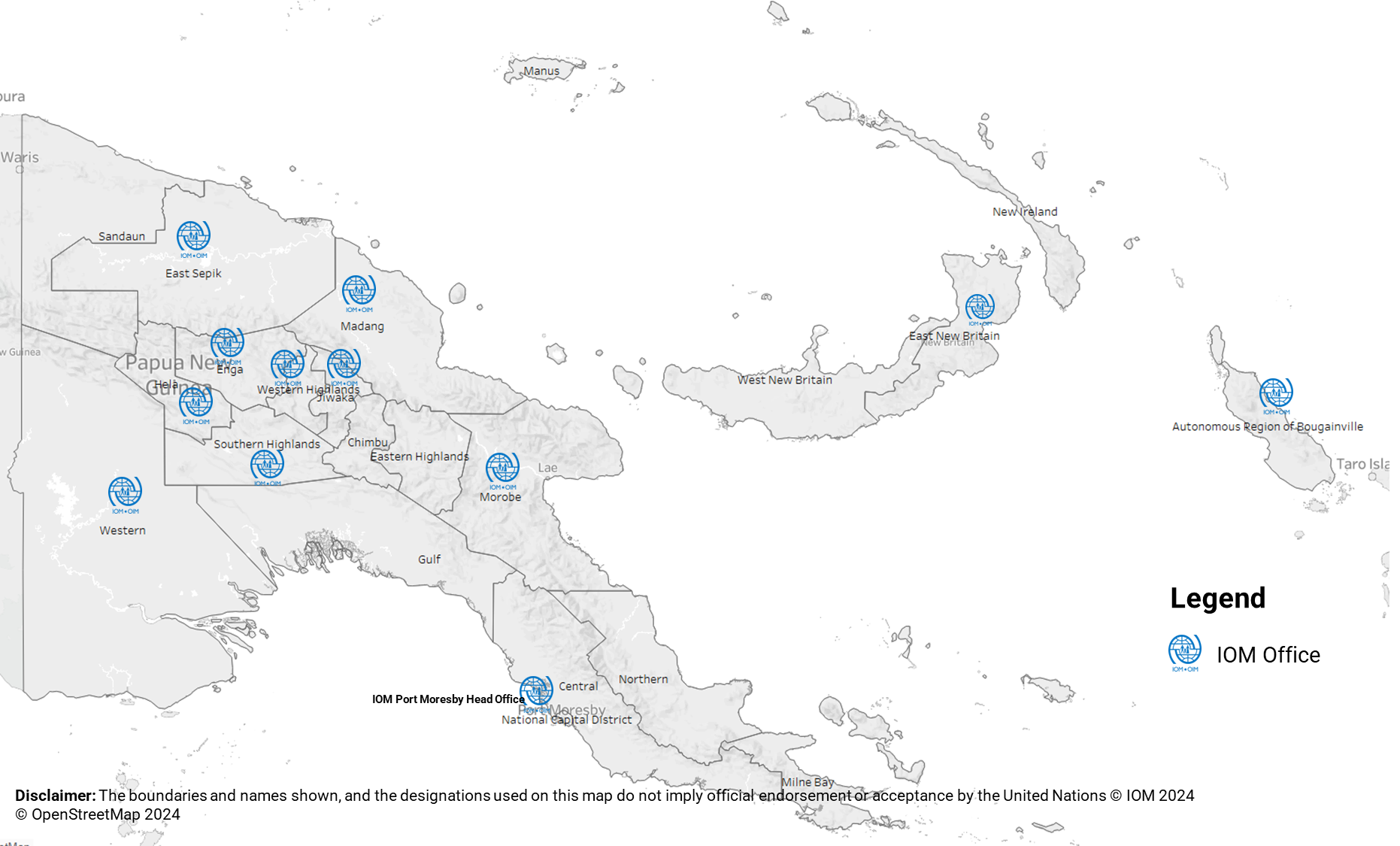
Papua New Guinea Neighbors
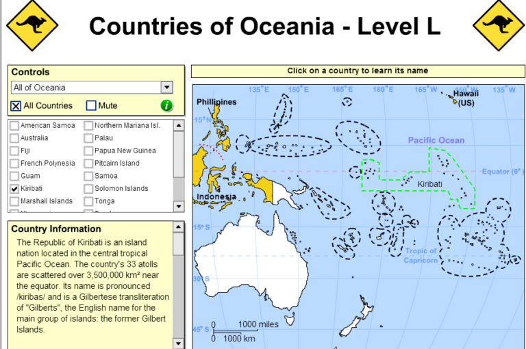
Papua New Guinea sits pretty in Oceania, rubbing shoulders and docking boats with some notable neighbors. These countries don’t just share a map with Papua New Guinea, they’re tied into its trade and international shenanigans.
Bordering Nations Overview
Papua New Guinea is linked up with two buddies across its borders: Indonesia and Australia. These borders kickstart some serious import-export action for Papua New Guinea.
Land Borders
Papua New Guinea splits the eastern side of New Guinea island with Indonesia, marking a zig-zag line about 820 km (509 miles) long. It’s a bit of a wiggly line, tagging along parts of the Fly River on its journey south-central. This barrier separates Papua New Guinea from the Indonesian provinces of Papua, Highland Papua, and South Papua (Wikipedia).
| Land Border | Length (km) | Neighboring Country | Notes |
|---|---|---|---|
| Indonesia | 820 | Indonesia | Trails along the Fly River |
For more on PNG’s amazing geography, take a peek at Geographical Extremes.
Maritime Boundaries
Papua New Guinea isn’t all about land; it’s got serious water action too. It keeps maritime company with:
- Australia: lounging to the south
- Solomon Islands: chilling to the southeast
These water lines matter for fishing, shipping, and keeping the seas safe.
| Maritime Border | Neighboring Country | Direction |
|---|---|---|
| Australia | Australia | South |
| Solomon Islands | Solomon Islands | Southeast |
Love islands? PNG’s got a stash, like the Bismarck Archipelago with New Britain, New Ireland, and the Admiralty Islands. Throw in Bougainville and Buka, part of the Solomon chain, plus a smattering of tiny islands and atolls (Britannica).
Get your grip on PNG’s geographic street cred as it cliques with neighbors, shaping up its global chatter. Compare it with neighboring countries of Malawi or dive into Madagascar’s neighborly map.
Geography of Papua New Guinea
Taking a look at Papua New Guinea’s geography gives us a peek into its neighboring pals, rugged lands, and some standout natural features—it’s like nature took a paintbrush and got creative!
Country Size and Boundaries
Papua New Guinea (PNG) ranks as the world’s third largest island nation, boasting a whopping land area of 462,840 km² (178,700 sq mi). Nestled in the southwestern Pacific, PNG occupies the eastern chunk of New Guinea island along with a bunch of offshore islands.
| Area (km²) | Area (sq mi) |
|---|---|
| 462,840 | 178,700 |
Land Borders
PNG cozies up to Indonesia along an 820 km (509 mi) border. This wiggly line wiggles through the Indonesian provinces of Papua, Highland Papua, and South Papua. The border does a little loop-de-loop by the Fly River in the southern heart of New Guinea (Wikipedia).
Maritime Boundaries
Besides bumping shoulders with Indonesia, PNG shares watery boundaries too:
- Australia: Just hanging out to the south
- Solomon Islands: Chilling to the southeast
PNG’s quirky spot on the map shapes its trade vibes and global dealings. Curious about how it vibes with its neighbors? Have a peek at luxembourg neighboring countries or malaysia neighboring countries.
Geographical Extremes
PNG struts around showing off its wild side—where dense jungles clash with soaring peaks.
Extent and Variations
Running like a backbone through PNG are the Highlands, packed with towering mountains. Yet, it’s not all peaks—coastal flats, big ole rivers, and scattered islands create an eclectic mix of landscapes.
| Feature | Description |
|---|---|
| Highest Point | Mount Wilhelm: 4,509 meters (14,793 ft) |
| Lowest Point | Sea Level |
| Point of Interest | Description |
|---|---|
| Mount Wilhelm | Standing tall at 4,509 meters (14,793 ft) and giving visitors a run for their oxygen. |
| Sepik River | Snaking its way over 1,146 km (712 mi), it’s one of the island’s mighty water highways. |
Want to dive into the geography vibe and see how PNG buddies up with other places? Check out our stories on mexico neighboring countries or malawi neighboring countries.
This mix of terrain and weather adds a splash of color to PNG’s cultural and ethnic quilt. The geography of Papua New Guinea shapes its special place among the Pacific’s nations, giving it a one-of-a-kind identity.
Economic Relations
Trade Partners
Papua New Guinea (PNG) is in cahoots with quite a few international trade buddies. Their big export pals include Australia, the European Union, Japan, China, and Singapore. These countries are the backbone of PNG’s economic stability, keeping things ticking along nicely.
| Country | Export Value (in millions) |
|---|---|
| Australia | 805.2 |
| European Union | 620.5 |
| Japan | 480.1 |
| China | 350.7 |
| Singapore | 290.3 |
Now, these folks aren’t just taking home PNG’s shiny pretty pebbles and crops, but a lot of sweet stuff exported from their land. If you’re curious about how other countries swing in their neighborhood, swing on over to our piece about Lithuania’s neighboring countries.
Aid Donors
When it comes to lending a helping hand, PNG leans heavily on foreign aid to keep its projects and government from hitting a wall. Australia sits at the top of the big spender list, coughing up a cool $479.2 million in 2023 (Wikipedia). Then there’s Japan, the European Union, China, the good folks at the United Nations, and a caravan of banks like the Asian Development Bank, the IMF, and the World Bank.
| Donor | Aid Contribution (in millions) |
|---|---|
| Australia | 479.2 |
| Japan | 200.0 |
| European Union | 150.5 |
| China | 120.0 |
| United Nations | 100.0 |
| ADB | 75.0 |
| IMF | 50.0 |
| World Bank | 45.0 |
All this dough mostly goes towards building bridges (literally and metaphorically), health care, and making sure everyone gets a decent shot at education. Wondering how countries lean on each other neighbor-wise? Check out our musings on NZ’s neighboring countries and Malawi’s neighbors.
Take a peek at how the jigsaw of geography and economic chit-chat fits in the Pacific and elsewhere by dropping by our scribbles on Madagascar’s neighboring countries and Malaysia’s neighbors.
International Associations
Papua New Guinea (PNG) is actively mingling in the global mix, building bridges and making friends in different international groups. Let’s take a look at its involvement with APEC and the WTO, and how it leans on foreign pals for aid.
APEC and WTO Membership
PNG got its APEC membership card in 1993, and it’s been rubbing elbows with major Pacific economies ever since (Wikipedia). APEC’s like a big meet-up for all things economic, helping PNG sharpen its trade game and streamline business affairs.
Fast forward to 1996, and PNG is shaking hands with the World Trade Organization (WTO) as well (Wikipedia). This move was all about playing by the global rulebook—lowering trade hurdles and making business less of a rollercoaster ride. Thanks to this club membership, PNG gets a smoother path to global markets to ship out its treasures like minerals, coffee, and palm oil.
Here’s when PNG joined these groups:
| Organization | Year Joined |
|---|---|
| APEC | 1993 |
| WTO | 1996 |
Dependency on Foreign Aid
PNG, ever since it flew solo in 1975, has leaned heavily on some worldwide buddies (Britannica). A bunch of international pals have chipped in, such as:
- Australia
- Japan
- European Union
- China
- United Nations
- Asian Development Bank (ADB)
- International Monetary Fund (IMF)
- World Bank
Australia’s the biggest donor, giving out funds for essential stuff like roads, schools, hospitals, and governance tweaks. Japan and the EU pitch in with agriculture, fisheries, and disaster prep. The UN and other global champs focus on safety net programs, climate fixes, and human rights chatter.
Check out who’s helping with what:
| Donor | Focus Areas |
|---|---|
| Australia | Infrastructure, Governance, Education, Healthcare |
| Japan | Agriculture, Fisheries, Disaster Resilience |
| EU | Sustainable Growth, Enviro Care |
| China | Economic Boom, Building Projects |
| UN | Safety Nets, Earth Defense, People Rights |
| ADB, IMF, World Bank | Money Matters, Economic Calm |
Want to know more about countries next door? Peek at articles like malaysia neighbouring countries and mexico neighbouring countries.
Foreign aid is like the trusty bandaid for PNG’s progress pains, helping it get past hurdles and find some steady ground.
Administrative Divisions
Papua New Guinea offers a mix of regions that are either independent or under administration. This section takes a closer look at the Indonesian provinces and how they fit into the area’s geography.
Indonesian Provinces
In the western corner of New Guinea, the Indonesian provinces of Papua and West Papua cover the territory. These areas are celebrated for their rich culture and loads of natural resources. Papua, which folks sometimes call Irian Jaya, along with West Papua, belong to Indonesia and make up the western side of the world’s second-biggest island (Britannica).
| Province | Area (sq km) | Population (approx) |
|---|---|---|
| Papua | 317,062 | 3.5 million |
| West Papua | 102,946 | 1 million |
To the east, these provinces share a border with Papua New Guinea. This line on the map was made official through a 1973 treaty between Indonesia and Australia. Papua New Guinea, back then, was pushing for independence, which came in 1975 (Wikipedia).
Geographic Split
On the eastern side of New Guinea lies the nation of Papua New Guinea. This split represents the main administrative and political divide on the island.
| Region | Administrative Division | Country |
|---|---|---|
| Western Half | Papua, West Papua | Indonesia |
| Eastern Half | Multiple Provinces | Papua New Guinea |
Papua New Guinea is a place of rugged mountains, thick forests, and a wild assortment of plants and animals. The separation between the Indonesian side and Papua New Guinea is reinforced by treaties focused on keeping things friendly, like the 1986 agreement renewed in 1990.
These divisions play a big part in shaping the politics and interactions happening across the regions on this island.
Check out more about nearby nations in our stories on Malaysia’s neighbors and Micronesia’s neighbors.
Ethnic Diversity and Languages
Cultural Composition
Papua New Guinea’s ethnic makeup is as colorful as a box of crayons thrown in the air. Folks from all shapes and backgrounds call this place home, with indigenous communities filling most of the Western, Northern, and Eastern coasts, easily throwing in a bit of the Austronesian (Melanesian) charm. Don’t be surprised if you find pockets of Polynesian, Chinese, and European settlers as well. It’s a melting pot like no other (Britannica).
Here’s a little roundup of who lives where in Papua New Guinea:
| Ethnic Group | Geographic Location |
|---|---|
| Austronesian (Melanesian) | Western, Northern, Eastern Coasts |
| Polynesians | Various Coastal Regions |
| Chinese | Urban Areas |
| Europeans | Urban Areas |
Official Languages
Talk about languages, and Papua New Guinea will throw hundreds your way. While some are more official than others, everybody’s speaking something.
Official Languages:
- English: The go-to language for government and schooling, as well as a common way to chat.
- Tok Pisin: This nifty creole language connects everyone like glue, no matter what tribe or tongue.
- Indonesian: You might hear this one near Indonesia’s border, a reminder of shared borders and past tales.
Craving more language vibes and comparisons with other islands? Check out marshall islands neighbouring countries and micronesia neighbouring countries.
A little cheat sheet for who’s talking what:
| Language | Status |
|---|---|
| English | Official |
| Tok Pisin | Widely Spoken Creole |
| Indonesian | Official in Bordering Regions |
If you’re looking to map out other nations’ people and languages, meander through pages like malawi neighbouring countries or madagascar neighbouring countries.
Papua New Guinea isn’t just a location on a map—it’s a living example of cultural and linguistic variety playing house together. Just think of nations like malaysia neighbouring countries and morocco neighbouring countries, where the languages and cultures mix and mingle with ease.
