Colombia Neighbouring Countries on the Map
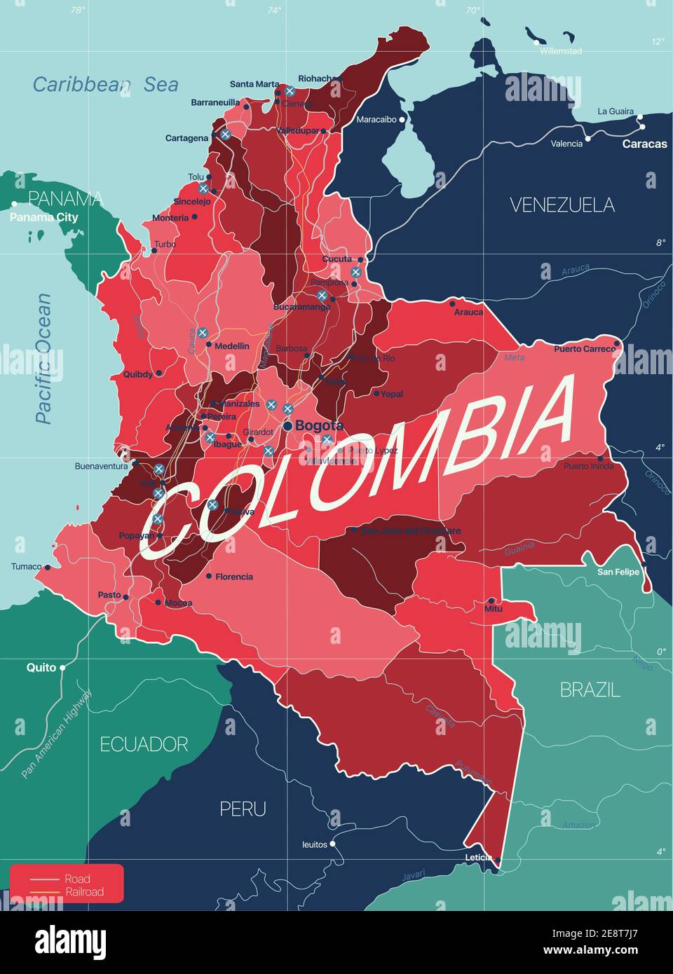
Colombia’s Neighboring Countries
Colombia cozies up to a quartet of neighbors, each bringing its own flavor of politics and culture to the party. Here’s what’s happening at the borders with Venezuela, Brazil, Ecuador, and Peru.
Bordering Venezuela and Brazil
Eastward, Colombia’s all buddy-buddy with Venezuela and Brazil. The line between Colombia and Venezuela isn’t just the longest at about 2,219 kilometers, but also the one spicing things up with a pinch of geopolitical drama. This lengthy division wends through Colombian spots like Norte de Santander and La Guajira and keeps a fair share of diplomats busy.
Then there’s the Colombia-Brazil border— it spans about 1,644 kilometers of untouched Amazon jungle vibes. This place embodies nature’s candy shop with its colorful critters and rivers that just won’t quit. Indigenous tribes enrich this area, adding layers of culture and tradition to the mix.
| Country | Border Length (km) |
|---|---|
| Venezuela | 2,219 |
| Brazil | 1,644 |
Sharing Frontiers with Ecuador and Peru
Turning south, you get the Colombia-Ecuador bromance. This 590-kilometer dance line takes you on a tour from the towering Andes down to lush Amazon lowlands. Think of it as Mother Nature strutting her stuff and smudging a bit of earth on trade and cultural exchanges.
Not to be outdone, the Peru-Colombia borderline stretches roughly 1,496 kilometers. It drifts through the depths of the Amazon rainforest— a Big Nature masterpiece. Here, preserving biodiversity is a biggie, and both countries have rolled up their sleeves, collaborating on treaties to keep their shared wilds and the rights of indigenous folks intact.
| Country | Border Length (km) |
|---|---|
| Ecuador | 590 |
| Peru | 1,496 |
For those itching for more geographical gossip, suss out our write-ups on brazil neighboring countries and peru neighboring countries.
All in all, Colombia’s got a prime spot in South America, rich with stories and landscapes that challenge the imagination. Its borders are not just lines on a map—they’re lively tales waiting to be told. If you’re hankering for more, mosey over to read about argentina neighboring countries and venezuela neighboring countries.
Colombia’s Border with Panama
Colombia’s land link with Panama is like a fun-sized candy bar—a little nugget of boundary goodness. It’s the shortest piece of the puzzle on the continental playground, but that doesn’t mean it’s all smooth sailing. Let’s take a fun peek at what makes this border tick, or rather, stretch.
Shortest Continental Border
Colombia’s border with Panama clocks in at a quick 266 kilometers (165 miles). It’s like the dim sum of borders! You start at the Cocalito and Ardita spots by the Pacific Ocean and wander up towards Cabo Tiburón on the Caribbean side—talk about coastal sightseeing (Wikipedia).
| What’s Popping | Details |
|---|---|
| Length | Short and sweet: 266 km (165 mi) |
| Pacific Hoedown | Kick it off at Cocalito and Ardita |
| Caribbean Pop Off | Wrap it up at Cabo Tiburón |
| Border Boss | Thank the Victoria-Velez Treaty of ’24 |
Dancing Through the Darién Zone
The Colombia-Panama border line cuts right through the Darién area, which is known for its ‘you shall not pass’ vibes. With its thick jungly forests and oh-so-swampy spots, it’s a place where even GPS might throw in the towel. It forms part of the Darién Province and is a shout-out for anyone who loves Mother Nature and risky paths (World Atlas).
Our old friend, the Victoria-Velez Treaty from 1924, is the rock behind this boundary biz, keeping Colombia and Panama’s friendship bracelet tight (World Atlas).
And hey, if you’re big on international lines of fun, we’ve also got you covered with more cool reads on Argentina’s neighboring hangouts and Brazil’s buddies across the border.
Colombia’s Maritime Boundaries
Overview of Maritime Borders
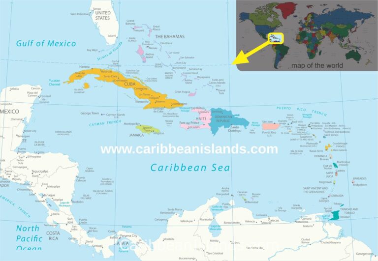
Colombia stretches from the tropical Caribbean to the vibrant Pacific, boasting a hefty stretch of maritime territory. With a mighty nine countries sharing ocean borders, Colombia’s water boundaries come with lots of rules for things like fishing, minerals, and boating through various sealed deals (Wikipedia). These boundaries aren’t just lines on a map; they’re like backstage passes to the ocean’s resources. Did I mention they’re super important for keeping everything smooth between neighbors?
Countries in the Caribbean Sea
In the sun-drenched Caribbean, Colombia buddies up to some next-door neighbors. Each country with its own slice of maritime pie, these boundaries help snag shared resources while keeping the peace among the sun-loving nations bordering this sapphire sea.
| Maritime Neighbor | Type | Key Aspects | Notable Treaties |
|---|---|---|---|
| Costa Rica | Caribbean Sea | Joint exploration and resource management | Treaty of Maritime Delimitation |
| Nicaragua | Caribbean Sea | Disputes over San Andrés and Providencia islands | ICJ Rulings |
| Honduras | Caribbean Sea | Defined maritime borders for fishing rights | Maritime Delimitation Treaty |
| Jamaica | Caribbean Sea | Negotiated fishing zones | Maritime Boundary Agreement |
| Haiti | Caribbean Sea | Delimited marine boundaries | Bilateral Agreements |
| Dominican Republic | Caribbean Sea | Collaboration on marine resources | Maritime Delimitation Treaty |
| Panama | Caribbean Sea/Pacific Ocean | Important trade and navigation routes | Victoria-Velez Treaty (World Atlas) |
Grasping Colombia’s maritime borders helps you get the big picture of their geopolitical and economic vibe. Running these water borders like a pro isn’t just about smooth seas; it’s about keeping everyone happy and ready to do some friendly dealing with the coastline neighbors.
Curious to know more about how neighbors connect globally? Check these out: Argentina’s next doors, Who Afghanistan rubs shoulders with, or Australia’s mates.
Peeking into Colombia’s neighboring nations and their water rules shows just how varied and interesting the area around Colombia truly is.
Significance of the Colombian-Brazilian Border
Stretching Through Amazonas Region
The Colombian-Brazilian border, clocking in as the second-longest stretch in Colombia, runs a good 1,645 kilometers (that’s 1,022 miles for my fellow Americans) (Wikipedia). This snaking line wiggles through the departments of Amazonas, Guainía, and Vaupés (Britannica).
Perched in the wild heart of the Amazonas region, this border is no walk in the park. Thick rainforests and meandering rivers make up the spot, a hotspot for biodiversity and home sweet home for indigenous communities. But it’s also got its share of woes, like illegal stuff swirling around—yeah, we’re talking about the drug trade. This has nudged Colombia and Brazil into holding hands to tackle such issues (World Atlas).
Delimited by Treaties
Now here’s a fun fact: this was the first Colombian border to get tied down with official treaties, way back in 1907 and then again in 1928. These treaties weren’t just dusty papers; they laid the groundwork for Colombia and Brazil to play nice and team up. (Wikipedia).
The border runs from the Amazon River around Leticia and stretches up to the island of San José in the Negro River. Check out this table for the lowdown on the treaties that nailed down this boundary:
| Treaty Year | Significance |
|---|---|
| 1907 | Initiated border delimitation |
| 1928 | Finalized and tweaked the border lines |
If your curiosity about borders knows no bounds, see how Colombia gets along with pals like Venezuela in our pieces on algeria neighbouring countries and andorra neighbouring countries.
These treaties don’t just draw lines on a map; they push Colombia and Brazil to buddy up on stuff like protecting the environment and cracking down on bad apples crossing the border.
The border isn’t just a line; it’s a gateway impacting cultural and economic swaps between these lands. Geek out on more about the party of Colombia’s bordering nations in our detailed reads on colombia neighbouring countries, argentina neighbouring countries, and brazil neighbouring countries.
The Colombian-Ecuador Border
Length and Geographical Terrain
Spanning 586 kilometers or a neat 364 miles, the Colombian-Ecuador border stretches like a well-strung ribbon from the roaring Pacific Ocean to the tranquil Putumayo River. This border cuts through Colombia’s departments, Nariño and Putumayo, showcasing a mixed bag of terrains. From breezy coastal scenes to towering mountains and tangled forests, it’s got everything.
| Parameter | Value |
|---|---|
| Length | 586 km (364 mi) |
| Start Point | Pacific Ocean |
| End Point | Putumayo River |
| Colombian Departments | Nariño, Putumayo |
Establishment Through Treaties
To nail down where one country ends and another begins wasn’t straight from the playbook. It took a bit of back-and-forth across time, especially since colonial days left things a smidge fuzzy. Eventually, some key agreements saved the day—the Suárez-Mujica and the Muñoz-Suarez-Muñoz Vernaza Treaties. These set the record straight and helped the neighbors live side-by-side without stepping on each other’s toes.
Want to explore more borders? We’ve got loads of other guides, like the ones on Argentina’s neighbors and those that surround Australia.
Challenges in the Colombia-Venezuela Border
The Longest Border for Colombia
Colombia and Venezuela share a whopping stretch of land that’s longer than any other border Colombia cuddles up beside, clocking in at a lengthy 2,219 kilometers (or 1,379 miles if you’re into that kind of thing). This vast strip meanders from the northern tip of La Guajira all the way down to where the Negro River decides to call it quits at Piedra del Cocuy (Wikipedia).
| Section | Length (km) |
|---|---|
| Total Border Length | 2,219 |
Traveling along this border line, you’ll encounter all sorts of scenery, from the basin around Lake Maracaibo to the north of the Arauca River. The ups and downs of the land make keeping tabs on what happens across this frontier an endless head-scratcher for both countries.
Disputed Territories and Departments
There’s no shortage of spats and squabbles along this border, fueled by a mishmash of social and economic problems that keep things simmering. Add in some disputed territories and departments, and you’ve got a recipe for continuous headaches for Colombia and Venezuela.
Notable Disputed Regions:
- Lake Maracaibo Basin:
- A patchwork of territories worth a pretty penny.
- Often a sore spot when it comes to who gets what.
- Arauca River Basin:
- Fertile grounds for farming and the like.
- A hotspot for ruffled feathers due to folks moving back and forth and goods changing hands.
For the latest scoop on global border quarrels, check out our other reads on Afghanistan neighboring countries, Albania neighboring countries, and Argentina neighboring countries.
Departments Impacted:
- La Guajira:
- Right there at Colombia’s northern peak.
- Also caught in crossfires between ethnic groups and indigenous folks.
- Norte de Santander:
- A buzzing hub for trading across the line.
- Swamped by a high tide of people on the move.
These places wrestle daily with problems like sneaky crossings, shady exchanges, and mass migrations. Limited help and faltering oversight only pour fuel on the fire for this borderland predicament. For more tales of border bumps and solutions, head over to our look into Angola neighboring countries.
