Niger Neighbouring Countries and West African Borders
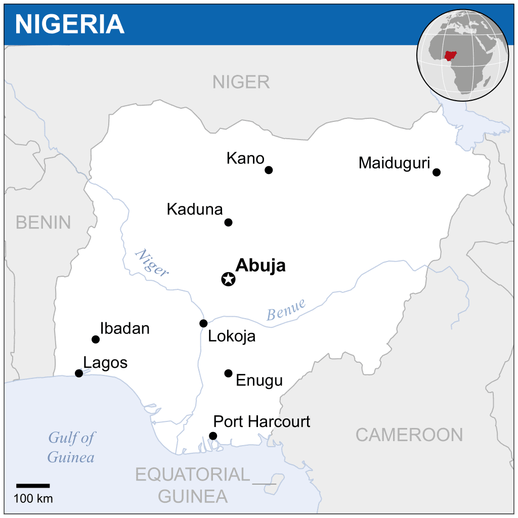
Niger’s Neighboring Countries
Niger, tucked away in the heart of West Africa, shares its boundaries with seven nations. Let’s take a closer look at the borders that define Niger’s place in the region.
Overview of Borders
Imagine Niger as a puzzle piece nestled among other countries: it has Algeria kissing its northern edge, Libya to the northeast, Chad waiting in the east, Nigeria sprawling below, Benin cozying up to the southwest, with Burkina Faso on its western side, and Mali rounding out the northwest. Knowing these borders helps us see how Niger fits into the broader political dance and trade in its neck of the woods.
Border Lengths
Niger’s total perimeter stretches about 5,834 kilometers. Here’s how that breaks down. Check out the table for a peek at each neighbor’s slice of the pie. Notice how Niger and Nigeria are particularly close, with the longest shared border.
| Country | Border Length (km) |
|---|---|
| Algeria | 951 |
| Libya | 342 |
| Chad | 1,196 |
| Nigeria | 1,608 |
| Benin | 277 |
| Burkina Faso | 622 |
| Mali | 838 |
(Source: Wikipedia, World Atlas)
Niger and Nigeria are practically best pals, sharing a border that stretches 1,608 kilometers. This connection fosters a wealth of trade and cultural mingling between them. Chad isn’t far behind in the friendship line with a boundary of 1,196 kilometers. Meanwhile, Benin keeps things short and sweet with just 277 kilometers.
Curious about how other parts of the world neighbor up? Check out our guides on lithuania neighboring countries and luxembourg neighboring countries.
These borders aren’t just lines on a map; they have a big say in everything from trade deals to green stuff like water management. Knowing where Niger stands helps us see why it matters in the grand scheme of West Africa.
Northward Neighbors
Niger hooks up with Algeria and Libya up north, making those borderlines pretty crucial for swapping goods, chit-chatting cultures, and keeping an eye on security mishaps.
Border with Algeria
Algeria stretches its arms out to Niger for a whopping 951 kilometers. It’s not a quick walk on the beach, though; we’re talking Sahara Desert vibes mixed with some rocky areas. No Disney-like towns here, just a whole lotta hot sand and a sprinkle of lonely hills.
| Country | Border Length (km) |
|---|---|
| Algeria | 951 |
If regional borders are your jam, our write-up on Morocco’s neighbors might tickle your fancy, giving you another taste of Northern Africa.
Border with Libya
Rolling over to Libya, there’s another 342 kilometers we gotta talk about. Surprise, surprise, it’s more of that sandy Sahara playground. Historically and politically, this stretch has seen folks trading, moving, and sometimes getting tangled in security drama.
| Country | Border Length (km) |
|---|---|
| Libya | 342 |
Zooming in on Niger’s neighbors sheds some light on its regional hustle and tussle. If you’re all about exploring who lives next door beyond this neck of the woods, hit up our bits about Myanmar’s buddies and Mexico’s border pals for some worldly wisdom.
Western and Southern Neighbors
Take a leisurely stroll along Niger’s western and southern lines, and you’ll stumble upon some intriguing geography and its neighbors and their stories. Nestled in West Africa, Niger rubs shoulders with a bunch of countries, each having its own interesting quirk in the geopolitical game.
Border with Chad
Let’s look at where Niger shakes hands with Chad. They’re neighbors for about 1,196 kilometers. Chad’s sitting as the fifth biggest player on the African continent and just like Niger, ain’t got no sea views. The Sahel’s dusty vibes dominate this stretch, with dry winds and parched lands as far as the eye can see.
| Border Parameter | Value (km) |
|---|---|
| Border Length with Chad | 1,196 |
Border with Nigeria
Head south and you’ll find the extended high-five Niger shares with Nigeria, making up their grandest stretch of shared terrain at 1,608 kilometers. Over this long line, there’s a lively swap of goods and tales, knitting the countries together with economic and cultural threads. The friendly Hausa folks along this strip keep the border chatter and cooperative vibes bustling. Curious for more on Nigeria’s neighborly escapades? Check our feature on nigeria neighbouring countries.
| Border Parameter | Value (km) |
|---|---|
| Border Length with Nigeria | 1,608 |
Border with Benin
A bit further south, Benin and Niger share a friendly nod along a 277-kilometer line. It may be the shortest handshake, but it’s packed with promise for trade routes and partnerships. This stretch flaunts a lively mix of nature, including slices of the Niger River basin—rich with life and essential for farming and fishing.
| Border Parameter | Value (km) |
|---|---|
| Border Length with Benin | 277 |
For more on how Niger mingles with its neighbors, check out our pieces on mali neighbouring countries and mauritania neighbouring countries.
Geographic Overview
| Neighboring Country | Border Length (km) |
|---|---|
| Chad | 1,196 |
| Nigeria | 1,608 |
| Benin | 277 |
Looking at Niger’s boundaries with Chad, Nigeria, and Benin, you get a patchwork of different influences and environments. Each line on the map tells a part of Niger’s larger story with its neighbors, stressing how these borders are key to connecting cultures, economies, and ecosystems.
Southeast and West Boundaries
Niger’s got its spot in West Africa surrounded by a bunch of neighbors that all have their part to play. When you look at its southeastern and western edges, you’ve got Burkina Faso and Mali lining up next to it.
Border with Burkina Faso
You’ll find the border with Burkina Faso running about 622 kilometers long (props to World Atlas for that). It’s over on West Niger’s side and it’s pretty vital for keeping trade lanes busy and buddying up regionally.
Key Points:
- Where’s It At?: Southwest border
- How Far?: 622 km
- Why It Matters: It’s all about that trade and teamwork
- Geography Bits: They share stretches of the Sahel and some semi-dry zones
If you’re eager to dig into more about how Niger gets on with its neighbors, hit up our section on Niger neighboring countries.
Border with Mali
Now, when it comes to Mali, we’ve got a longer stretch—a whopping 838 kilometers of border (our tip-off comes from World Atlas). This western edge is a big deal both politically and economically.
Key Points:
- Where’s It At?: Western side
- How Far?: 838 km
- Why It Matters: Joint efforts and all that trade jazz
- Geography Bits: Mostly desert with a side of Sahel
Got an itch to know more about this nation-linking scene? Check out our write-up on Mali neighboring countries.
Summary of Border Lengths
| Country | Border Length (km) |
|---|---|
| Burkina Faso | 622 |
| Mali | 838 |
These aren’t just lines on a map—Niger’s geography, with its mix of natural zones and eco-details, adds another layer to how it meshes with the countries next door. For more intel on this scene, pop over to our section on geographic divisions.
Geographic Divisions
Niger’s geography is like a giant jigsaw puzzle with its mix of unique natural zones and ecological marvels.
Natural Zones
Niger splits into three main zones: the desert, the in-between space, and the farming lands.
-
Desert Zone: Up north, it’s all about sand dunes and rocky stretches. Ever heard of the Ténéré region? It’s part sandy desert, part stony plain, giving you that classic desert vibe.
-
Intermediate Zone: Smack dab in the middle, you’ll find folks who move around with their flocks of cattle. This area is like a buffer, blending the harsh deserts with the agricultural heartland down south.
-
Cultivated Zone: Down south, life is a tad more comfortable, with fertile lands supporting farming. Think rolling savanna and hills where people can grow their crops (Wikipedia).
Ecological Features
Niger’s got some cool ecological sites that match its geography:
-
Deserts and Semi-deserts: Most of the north is desert land, with places like the Ténéré offering a mix of sand and stones. Imagine endless expanses of exotic desert vistas (Britannica).
-
Seasonal Lakes and Pools: Rainwater hangs around in many parts, forming lakes and pools. Look out for spots like Keïta, Adouna, Madaroumfa, and Guidimouni. Artesian wells here draw water from deep underground, proving how precious water is.
-
Niger River: This mighty river snakes through about 350 miles of the country, fed by streams from the right bank. Rivers like Gorouol, Dargol, and Sirba pitch in to make Niger’s water scene what it is (Britannica).
Niger’s zones and nature matter big-time for its land and people. Curious about economic angles? Check out our section on Economic Relationships in Niger.
| Natural Zone | Description | Key Features |
|---|---|---|
| Desert Zone | Northern region | Deserts, semi-deserts, Ténéré region |
| Intermediate Zone | Central region | Nomadic pastoralism, mixed landscape |
| Cultivated Zone | Southern region | Savanna, hills, agriculture |
Want more on Niger’s border buddies? Niger’s neighboring countries will give you the lowdown on its regional surroundings.
Economic Relationships
Niger’s economic life is heavily influenced by its trading ties and the sniffles it catches along the way. Wrapping your head around these connections shows how Niger mingles with its neighbors and the folks beyond its borders.
Trade Partners
Niger’s all in for getting cozy with African nations and jumps right into regional buddy-buddy gatherings like the Economic Community of West African States (ECOWAS). Its main trade buddies are Nigeria, France, and China (Britannica). These pals are big-time players for swapping goods, keeping the wheels of progress turning.
| Country | Trade Relationship Vibe |
|---|---|
| Nigeria | Big shot in farming stuff and energy |
| France | Go-to for fancy gear and techy stuff |
| China | Major player in roads and buildings |
In Niger, farming sure earns its bread and butter. They’re all about millet, sorghum, cassava, and sugarcane down south, while rice enjoys its day in the sun along the Niger River valley (Britannica). Swapping these farm treasures across borders keeps many Niger folks going.
Economic Challenges
Niger doesn’t have it all easy, facing hurdles that trip up its trade tango. One nagging issue is the border drama, like shutdowns that send prices skyward for must-haves. Take that border kerfuffle with Benin; it pushed up food costs, jacking up inflation from 1.7% in June 2023 to 15.5% in June 2024.
| Challenge | Fallout |
|---|---|
| Border Shenanigans | Rising grub costs and inflation eruptions |
| Refugee Waves | Nearly a million needy souls putting a strain on things (World Bank) |
| Power Access | Over 4.5 million folks left mostly in the dark (World Bank) |
The power situation? Yeah, that’s a tough nut for Niger to crack. The World Bank is chipping in with $1,207.5 million to get some lights on for everyone.
Facing these hiccups sheds light on why Niger treasures steady trade ties and cooperation vibes in the region. Want to dive more into the border banter and neighborly dynamics? Check out articles on luxembourg neighbouring countries and mali neighbouring countries.
Regional Organizations
Participation in ECOWAS
Niger rolls up its sleeves and dives headfirst into various regional clubs that make pals out of national borders. Among the top dogs is the Economic Community of West African States, better known as ECOWAS.
ECOWAS buddies up the countries in the area, helping them grow their economies like a gardener helps plants flourish. Sitting snugly in West Africa, Niger rubs shoulders with its ECOWAS buddies like Nigeria, Benin, Burkina Faso, and Mali. Thanks to ECOWAS, doors to a huge market swing open wide for Niger’s goods and services, which spells out economic boost city!
Getting Niger’s stuff across borders involves more than shaking hands. Trucks trek between places like Maradi and Zinder in Niger and Kano in Nigeria, and zip from Niamey to Parakou in Benin. And don’t forget those oldies but goodies—camel caravans and nimble canoes—that keep connections alive in the Sahel and along Lake Chad and the Niger River.
Flying’s another trick Niger’s got up its sleeve. Niger Airlines connects domestic dots like Maradi, Zinder, Agadez, and Dirkou. Niamey airport throws open its gates to the world too, connecting folks near and far (Britannica).
| Key Transport Routes | Connecting Points |
|---|---|
| Maradi – Zinder | Kano, Nigeria |
| Niamey | Parakou, Benin |
| Domestic Air Services | Maradi, Zinder, Agadez, Dirkou |
| International Airport | Niamey |
Want more scoop on neighboring nations? Check out more goodies about Mali’s neighbors and Nigeria’s neighbors.
Creation of AES
In a game-changing move, Niger, Burkina Faso, and Mali decided ECOWAS wasn’t fitting like a glove anymore. So, in January 2024, they hit the exit ramp and teamed up to create their own gang—the Confederation of States of the Sahel (AES). This AES club hopes to steer and better tackle some tricky regional issues.
AES has its gaze on tackling bumpy roads like safety concerns, economic growth, and social unity. By zooming in on their own needs, the AES looks to address what really matters for their members, ensuring more targeted and effective support.
The birth of AES notes how dynamic these regional ties can be in West Africa. By reinventing who they partner with and how they do it, Niger, Burkina Faso, and Mali aim to patch up a stronger and a more united Sahel area.
Curious about other global connections? Peek at our articles on what’s happening with Luxembourg’s neighboring countries and what Madagascar’s neighbors are up to.

